


- READ MORE: Live - Byron Bay billionaire strip warned to flee lavish mansions as Cyclone Alfred bears down and a woman is swept away by a freak wave
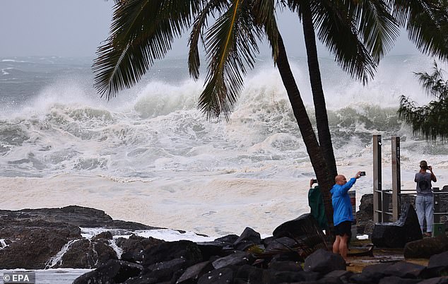
Tropical Cyclone Alfred is on track to make landfall on Friday night into Saturday, bringing winds upwards of 120km/h, up to 700mm of rain and flooding.
It could be the most devastating weather pattern seen in south-east Queensland and north-east New South Wales as it is the first tropical to hit the region in more than 50 years.
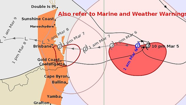
A warning zone stretching 650km remains in place from Double Island Point in Queensland to Grafton in northern NSW.
The zone includes Brisbane , the Gold Coast , Sunshine Coast, Byron Bay and Ballina, but doesn't include Grafton.
At 1am on Thursday, Alfred was 325km east of Brisbane and moving at 7km/h.
The Bureau of Meteorology forecasts that Alfred will make landfall, potentially directly over Brisbane, at 7pm on Friday.
'The centre of Alfred is expected to cross the coast during Friday, noting that latest weather model data indicates the potential for a later crossing time than previously indicated,' the bureau said.
'Location of crossing still remains most likely between Maroochydore and Coolangatta.'
Alfred was initially predicted to reach land in the early hours of Friday morning.
'Alfred is a category 2 cyclone and is forecast to maintain this intensity as it continues to approach the south-east Queensland coast.'
Where is tropical cyclone alfred likely to cross the coast?
- The category two system is predicted to hit south-east Queensland between Brisbane and the Gold Coast, crossing the coast early on Friday
- The system has recorded winds up to 90km/h at its centre and gusts of 130km/h
- It is forecast to bring daily rainfall totals between 200mm and 400mm from Thursday to Saturday, likely leading to 'life-threatening' flooding
What is Cyclone Alfred's impact zone?
- The cyclone warning zone spans Double Island Point, Queensland to Grafton, NSW, with Brisbane, the Gold Coast and hinterland to cop the brunt of strong winds
- Its arrival will coincide with high tide in Queensland, possibly affecting 20,000 properties in Brisbane, almost 5,000 on the Sunshine Coast and 6,000 on the Gold Coast
- Almost 200 swift water-rescue personnel are on standby along with 1,000 energy crew staff
- Australian Defence Force assistance has been activated with helicopters deployed to Bundaberg and Coffs Harbour
- The northern NSW towns of Ballina and Lismore are also preparing for the cyclone
- Evacuation centres will open across Queensland's south-east and northern NSW
- About 300,000 sandbags have been sent to the region, according to the SES
- It has already got more than 4,000 calls for assistance
Services that have been impacted
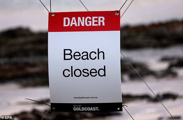
- Public transport in south-east has been suspended since Wednesday night
- No vessels are permitted on the water until further notice, the Brisbane Regional Harbour Master warns
- More than 500 schools to close from Thursday in Queensland with almost 250 to shut in northern NSW
- South-east Queensland's major roads and bridges to close once winds reach 90km/h
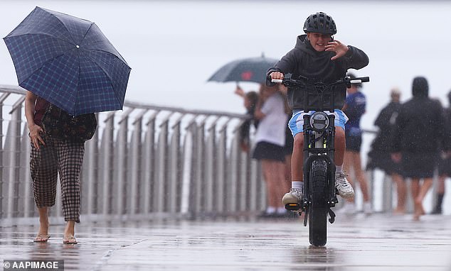
- Elective surgeries will be suspended from Thursday with south-east Queensland residents urged to stay at home over the coming days
- State-federal disaster assistance has been activated for 12 local government areas
- An emergency childcare declaration has allowed for support to services and families in 15 cyclone-affected local government areas
SES issues flood warnings for northern NSW
A Watch and Act for flooding - prepare to evacuate has been issued for:
- Uki and surrounds
- Kingscliff North Caravan Park
- South Beach Road, Harbour Way and Reflections Massy Green Holiday Park
- New Brighton
- Belongil
- South Golden Beach
- Pottsville
- Ballina CBD and surrounds
- Hastings Point
- Kingscliff Holiday Park and properties along Cudgen Creek
- Fingal Head
- The Flat
- Kyogle and surrounds
- Kyogle North Chinderah and surrounds
- People in Belongil and Byron industrial, Lower Uki and surrounds and Coraki Caravan Park have been told not to enter floodwater.